

Author: Asa Letourneau
Online Engagement Officer
Up until now it has not been possible for the public to annotate digitised records from the collection to allow others to find them more easily. With the recent addition of an annotation tool on the PROV Map Warper site, this has changed. Anyone with a Map Warper account can now annotate maps with names, geographic features, flora, buildings, building construction materials and all manner of interesting facts that could help others in their research journeys. The tool could be seen as PROV’s first baby steps in the direction of crowdsourced annotation marking an important moment in allowing researchers to make valuable contributions to the archives.

Let’s get started!
Annotating maps on Map Warper is incredibly easy but it probably pays to have a quick look at the step by step guide here. https://mapwarper.prov.vic.gov.au/help Just remember you need to have a Map Warper account to add or search annotations. It’s just like Wikipedia!
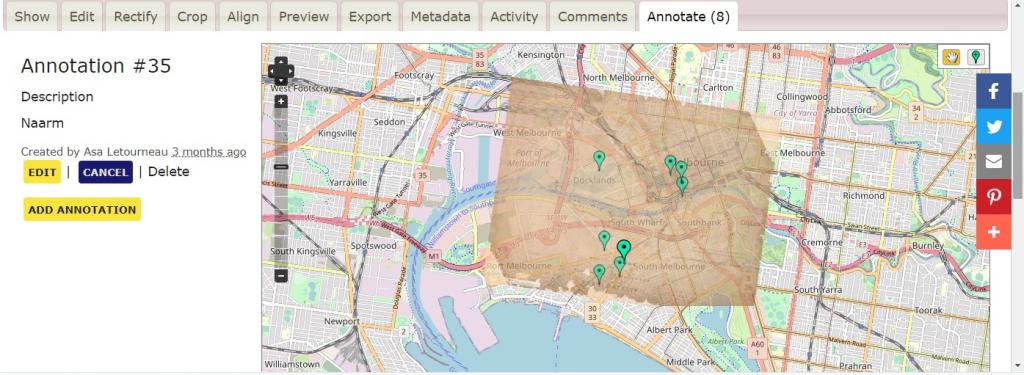
Here’s one I prepared earlier
With over 12,000 historic maps and plans on the PROV Map Warper and over half of those already ‘rectified’ or placed on their present day location, you’re bound to find something interesting to annotate. A great place to start is VPRS 8168, the Historic Plan Collection with maps dating back to 1802. https://mapwarper.prov.vic.gov.au/maps?utf8=%E2%9C%93&field=text&query=8168&from=1800&to=1979&show_warped=0 Remember you can only annotate rectified maps so please have a go at rectifying any unrectified maps you see so others can annotate them. Once again there’s a simple step by step guide to rectifying maps here. https://mapwarper.prov.vic.gov.au/help
To help you understand the power of annotation for search let’s have a quick look at one I prepared earlier. It literally took me 2 minutes to annotate buildings, flora types and geographic features which all means that in the future if a researcher wants to search across all maps for any of these terms they will be able to do exactly that! Imagine being able to understand how climate change has altered the environment throughout history?
It’s TROVE for maps
We hope you will join our army of PROV Map Warper rectifiers and annotators so we can all find records more easily in the future. We are incredibly excited by and our new annotation tool and hope you find it useful in your research.
Material in the Public Record Office Victoria archival collection contains words and descriptions that reflect attitudes and government policies at different times which may be insensitive and upsetting
Aboriginal and Torres Strait Islander Peoples should be aware the collection and website may contain images, voices and names of deceased persons.
PROV provides advice to researchers wishing to access, publish or re-use records about Aboriginal Peoples