

Author: Asa Letourneau
Online Engagement Officer
In our last blog we looked at how Public Record Office Victoria’s (PROV) Map Warper tool can be used to both spotlight cities and show change over time with insights from professional historian Abi Belfrage. In part two of our three part series, with the help of academic Ben Mountford, we will explore Ballarat’s geography, historic sites and local infrastructure through the lens of Map Warper.
Regional maps (Ballarat)
Ben Mountford is Associate Professor of History at the Australian Catholic University in Melbourne and Ballarat. His research focuses on Global and Imperial History, Modern British History, and Australian History. He is currently working on the global history of the nineteenth century gold rushes.
PROV’s Map Warper currently has 593 maps and plans covering Ballarat and its surrounds, dating back to 1852. One of the more intriguing maps is below.
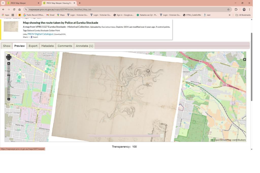
Map showing the route taken by Police at Eureka Stockade
The curious thing about this 1854 map is that it locates the Eureka Stockade some distance north west of the late nineteenth century Eureka Memorial and the modern day Eureka Centre. Moving the opacity slider on the tool makes this clear.
Ben has some thoughts of his own concerning this:
“One of the things I love about this map is that it gives us an insight into the relationship between history and memory. During the 1870s and 1880s, there was a movement to commemorate the site of the 1854 Eureka Stockade – which eventually led to the erection of a monument in 1884. The problem was, the Stockade took place in the middle of a mining landscape (contemporary illustrations show it looking like the surface of the moon) so remembering exactly where it happened was a fairly imprecise process based on people’s recollections. That the map here comes up with a different location reminds us of the ways historical sources don’t always line up – and that they are often more interesting when they don’t.” -Ben Mountford
What else can Map Warper reveal about Ballarat?
Well, this Parish Plan, drawn and reproduced in 1964, shows us how little transformation is created by changes in land ownership - at least to the overall footprint of these areas. Once again, the opacity slider allows us to easily compare the sixties to the present day.
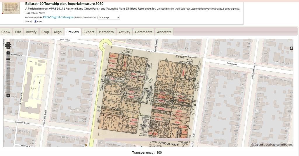
Ballarat -10 Township plan, Imperial measure 5030
Other historic plans detail topographical information such as the one below.
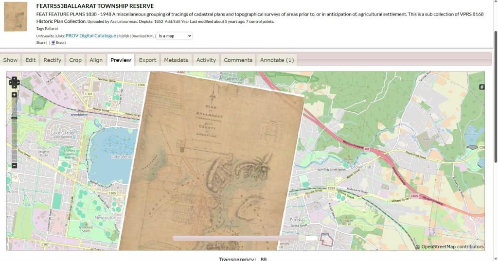
FEATR 553 Ballarrat Township Reserve
Explore all three-dimensions
Another handy feature of Map Warper is the ability to view it in on Google Earth where you can zoom in to ground level, tilt up to the horizon and see the topography in 3D.
“The Google Earth interface is great in that it enables us to get a sense of the topography of the areas we are studying. We have the ability to understand what it is like being in the landscape, rather than just experiencing it through the 2D map.” - Ben Mountford.
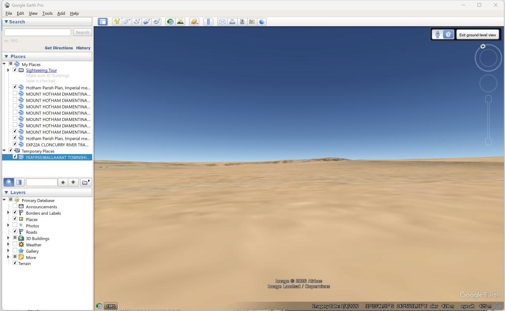
Google Earth view of FEATR553 Ballarrat Township Reserve
The map below highlights how Map Warper can reveal the infrastructure of a region. In this case, the important establishment of railway lines that like telegraph lines were the NBN of the day. The map below from 1860 shows a portion of the the railway line connecting Ballarat to Geelong.
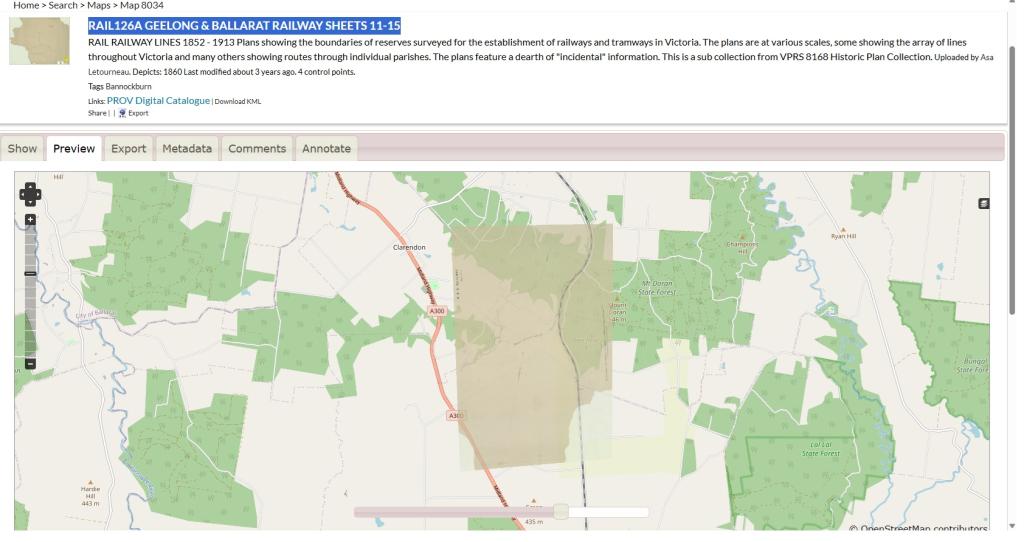
RAIL126A Geelong and Ballarat Railway Sheets 11-15
Layers of history unpeeled
So how Does Ben Mountford see his research going forward with the use of the PROV Map Warper?
“One of the things I find most wonderful about Map Warper is the chance to peel back the layers of history, to think about the shifting of space and time together.
“The eminent historian John Lewis Gaddis, once wrote: ‘If you think of the past as a landscape, then history is the way we represent it, and it’s that act of representation that lifts us above the familiar to let us experience vicrariously what we can’t experience directly: a wider view.’ (John Lewis Gaddis, The Landscape of History: How Historians Map the Past. Oxford: Oxford University Press, 2002, 19).
“Map Warper is an amazing tool for mapping our history this way – from big moments like the Eureka Stockade, to more intimate stories of our street or neighbourhood.” - Ben Mountford.
Get started on Map Warper
Explore the maps of PROV’s Map Warper at mapwarper.prov.vic.gov.au
If you’d like to help rectify and annotate the maps, make sure to create a free account and watch the explainer video for tips!
Material in the Public Record Office Victoria archival collection contains words and descriptions that reflect attitudes and government policies at different times which may be insensitive and upsetting
Aboriginal and Torres Strait Islander Peoples should be aware the collection and website may contain images, voices and names of deceased persons.
PROV provides advice to researchers wishing to access, publish or re-use records about Aboriginal Peoples