

Author: Asa Letourneau
Online Engagement Officer
Public Record Office Victoria’s (PROV) online Map Warper tool was first launched back in 2019. Since then, it has become an invaluable site for researchers to explore changes to Victoria’s landscape over time.
Users of the tool can ‘rectify’ historic maps and plans (meaning to place them over present day map coordinates), or simply view the maps already rectified to enhance their research.
Over the next three weeks we will post a series of blogs exploring how Map Warper is used by professional historians and academics to delve into the history of specific places, landscapes and sites across Victoria.
A new reality for researchers (Merri Creek)
Abi Belfrage is an award-winning professional historian, consultant with The History Dept. and ex-PROV staff member. In 2007, whilst working at PROV, Abi wrote an article for our online journal Provenance titled ‘A Stroll Along the Merri’, in which she expertly used archival research, photographs and her own environmental sound recordings to explore the cultural landscape of Melbourne’s inner north.
Abi recently explored the area using Map Warper, and explains how her research process has changed since she wrote her article almost ten years ago.
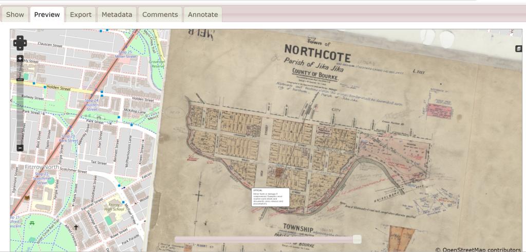
Northcote Cty @ Jika Jika, Imperial measure N5603
Northcote Cty @ Jika Jika, Imperial measure N5603
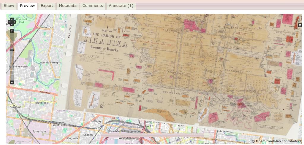
SYDNEYJ1 JIKA JIKA
Jika Jika - part Parish Plan, Imperial measure J2796-1
“The plans of Melbourne’s inner north are stunning and full of information. They would have added context and visual appeal to my Merri Creek article. If map warper, and the abundance of PROV’s digitised maps and plans, were around in 2007 when I wrote my Merri piece, I would have easily been able to find and incorporate elements from these gorgeous records. To do so back then, I would have had to find them on the catalogue and order in the original plans, and get them digitised, and, if they were from the Historic Plan Collection VPRS 8168, seek permission from the Victorian Surveyor-General to use them in the piece, which might have taken several weeks. Back then I used a black and white image from a microfiche set of parish plans, which was the quickest way to access and reproduce this information. To access these I had to know which series to look in and which parish I needed.
“Compared to that process, with Map Warper, us researchers are on warp speed (sorry for the pun) when searching for and accessing copies of historic maps and plans. Being able to search by location using an address, or simply browsing with the map interface, means we can see the exact coverage of each map or plan. We can also search multiple series at a time without having to identify which series to use, which is a barrier for some researchers. Then for people who know the Historic Plan Collection and want to look in particular areas of it, such as Coastal Surveys (CS) or Feature Plans (FEAT) there are still great text search and browse options that let you do this. It is great to know that this resource is growing and new records are being added and rectified. My only concern with Map Warper is that it’s so fun to use, it might put me out of business!” - Abi Belfrage.
Changes to Melbourne’s urban landscape (Hoddle Grid)
Another example of how Map Warper can show change over time can be found when looking at the Melbourne CBD famously pegged out by Robert Hoddle in 1837.
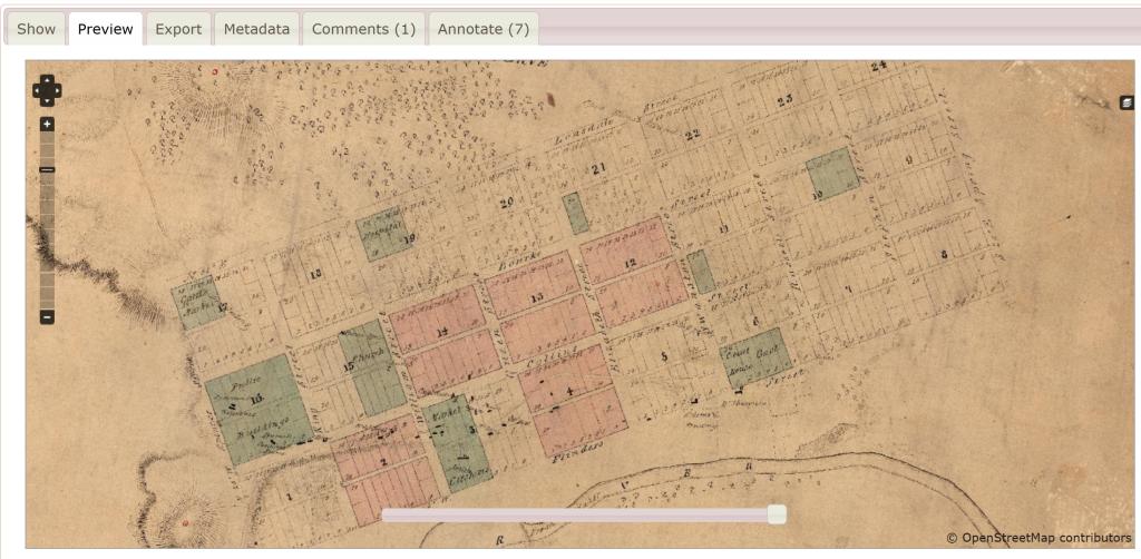
SYDNEYM26MELBOURNE
If we zoom into the CBD in this interactive map, we can then use the opacity slider to view contemporary Melbourne underneath Hoddle’s 1837 survey. It’s remarkable what has changed, and conversely what hasn’t changed, in the last 189 years.
Consider for instance:
- Custom’s House in 1837 is now the Melbourne Immigration Museum
- The portion of the turning basin of the Yarra was salt water
- Modern-day Docklands was once an expanse of ‘Marshy Plain’!
The grid itself however, or Hoddle Grid, has remained.
Coastal development and the environment (Wilson’s Prom)
Map Warper also provides historians with an excellent resource for reviewing changes in coastal regions due to environmental pressures or conversely how robust nature is in retaining its key features despite decades of development.
See below a map from the Miscellaneous Coastal Surveys subcategory of the Historic Plan Collection depicting Port Phillip Bay to Wilsons Promontory in 1896, and our final example of Bass Strait 1843.
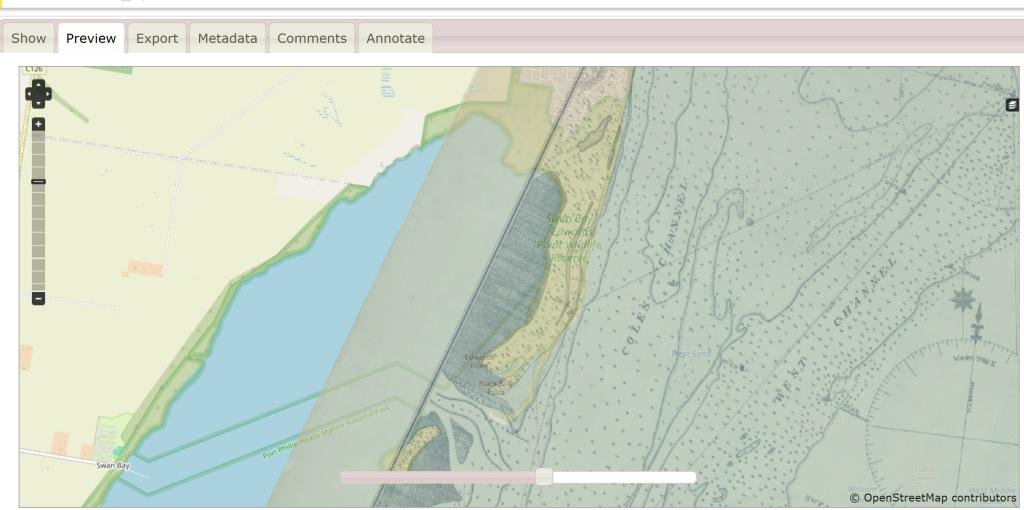
MCS7 PORT PHILLIP BAY TO WILSONS PROMONTORY
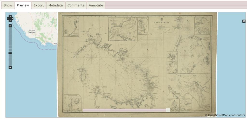
Cs73E Bass Strait
Get started on Map Warper
Explore the maps of PROV’s Map Warper at mapwarper.prov.vic.gov.au
If you’d like to help rectify and annotate the maps, make sure to create a free account and watch the explainer video for tips!
Material in the Public Record Office Victoria archival collection contains words and descriptions that reflect attitudes and government policies at different times which may be insensitive and upsetting
Aboriginal and Torres Strait Islander Peoples should be aware the collection and website may contain images, voices and names of deceased persons.
PROV provides advice to researchers wishing to access, publish or re-use records about Aboriginal Peoples