
Last updated:
We hold historic records from many local governments, but none in as much quantity and diversity as those from the City of Melbourne council.
Scroll below to see a number of record collections about the City of Melbourne.
Historical context
The earliest records are from 1841, and cover a number of areas including electricity supply, the construction of buildings, and licenses to brew alcohol. After the establishment of a Colony-wide Parliament (‘responsible government’) in 1856, the Melbourne Council assumed the roles we are familiar with today: rates, roads and rubbish; as well as parks, public art, real estate, markets and working with the diverse range of people and businesses that make up a major world city.
What do I need to know before I start?
- If you are looking for an individual it is very useful to know their address in the city
- If you are researching a business, address and dates of operation are important
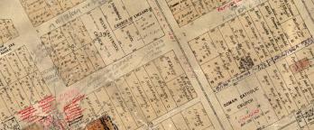
The boundaries of the City of Melbourne changed several times in the nineteenth century, covering parts of inner-city suburbs Collingwood, Fitzroy, Richmond, South Melbourne and St Kilda. You may need to look at the records of these municipalities as well. The State Library of Victoria has digitised a set of early Sands and MacDougall maps of Melbourne that show the Council boundary. You can find a link to this map on the right under Researcher resources.
View online or at the Reading Room?
Look for these icons to:

View online

Visit Us
Material in the Public Record Office Victoria archival collection contains words and descriptions that reflect attitudes and government policies at different times which may be insensitive and upsetting
Aboriginal and Torres Strait Islander Peoples should be aware the collection and website may contain images, voices and names of deceased persons.
PROV provides advice to researchers wishing to access, publish or re-use records about Aboriginal Peoples


 & winner E. Krzesinska (Poland) share a hug, VPRS 10742/P0, Unit 8, Item A696")

